Log in
All resources
Create a design
33,440 Free Images of 1736 Maps
geographical illustrations by coronelli
old maps of the peloponnese
files from the bodleian libraries
theatrum orbis terrarum (london 1606)
old maps of governorates of the russian empire
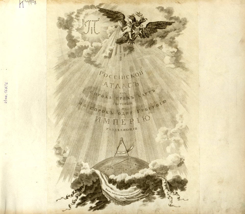
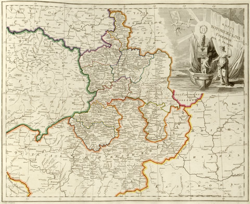
atlas of the russian empire (1800)
maps in the library of congress
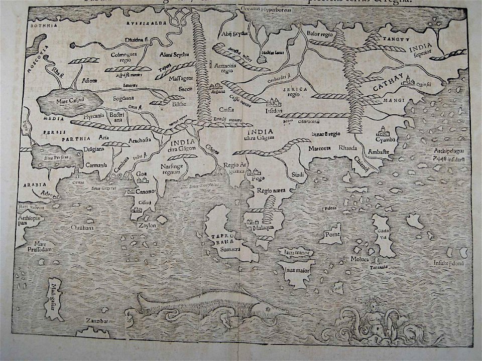
illustrations of cosmographia (münster)
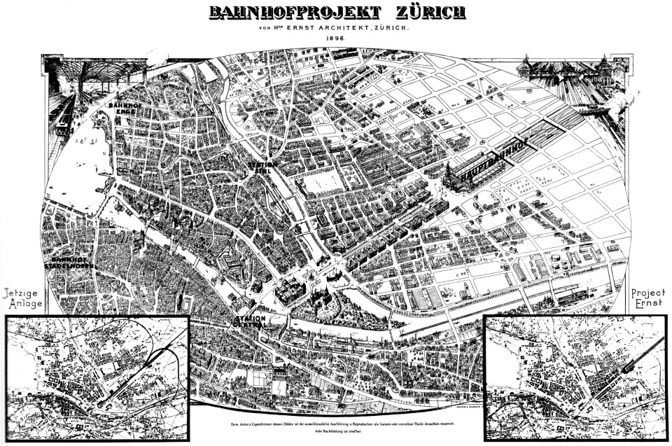
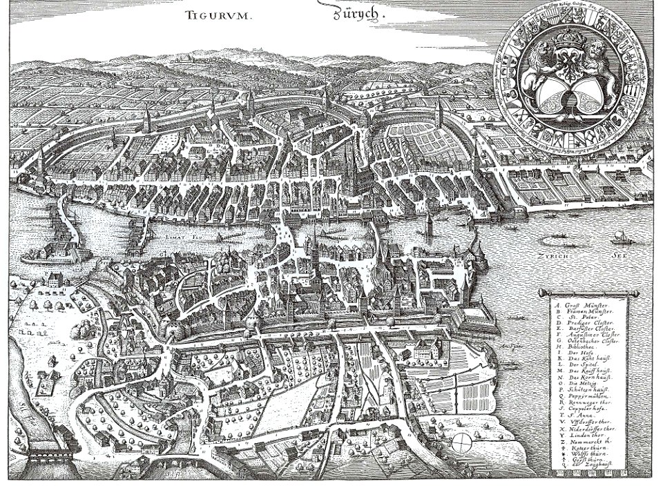
old maps of zürich
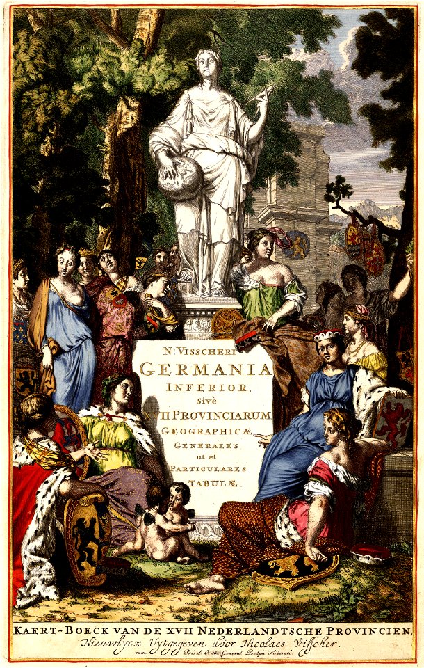
atlas van der hagen
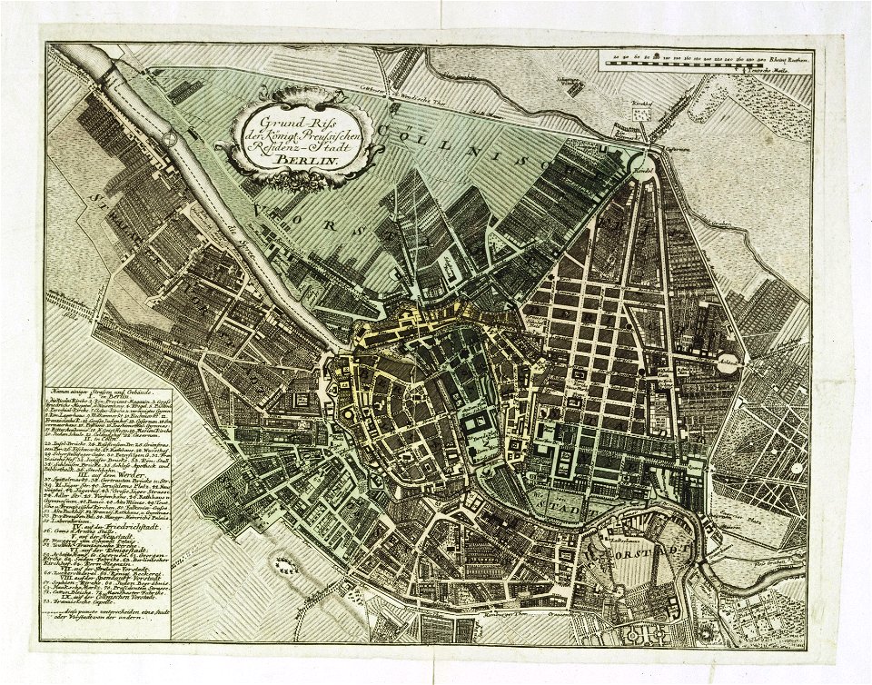
18th-century maps of berlin
johann david schleuen
postcards of germany by eugen felle
bird's-eye view postcards
illustrations of cosmographia (münster)
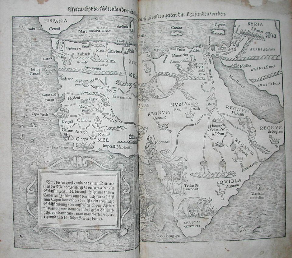
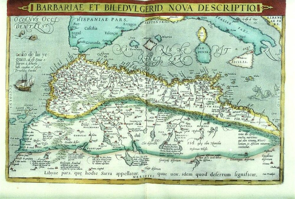
old maps of africa
illustrations of cosmographia (münster)
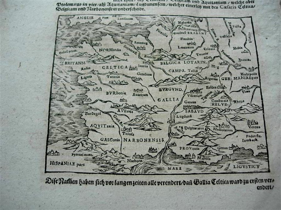
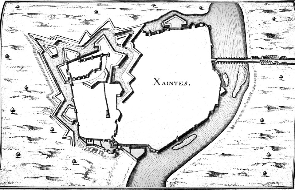
old maps of france
images of artefacts of the king baudouin foundation
abraham ortelius
maps in the biblioteca nacional do brasil
joinville
engravings by matthäus merian
kassel
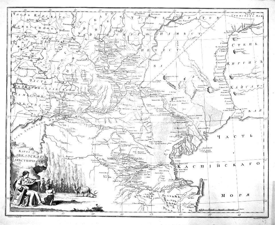
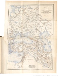
old maps of viceroyalty of the caucasus
atlas of the russian empire (1792)
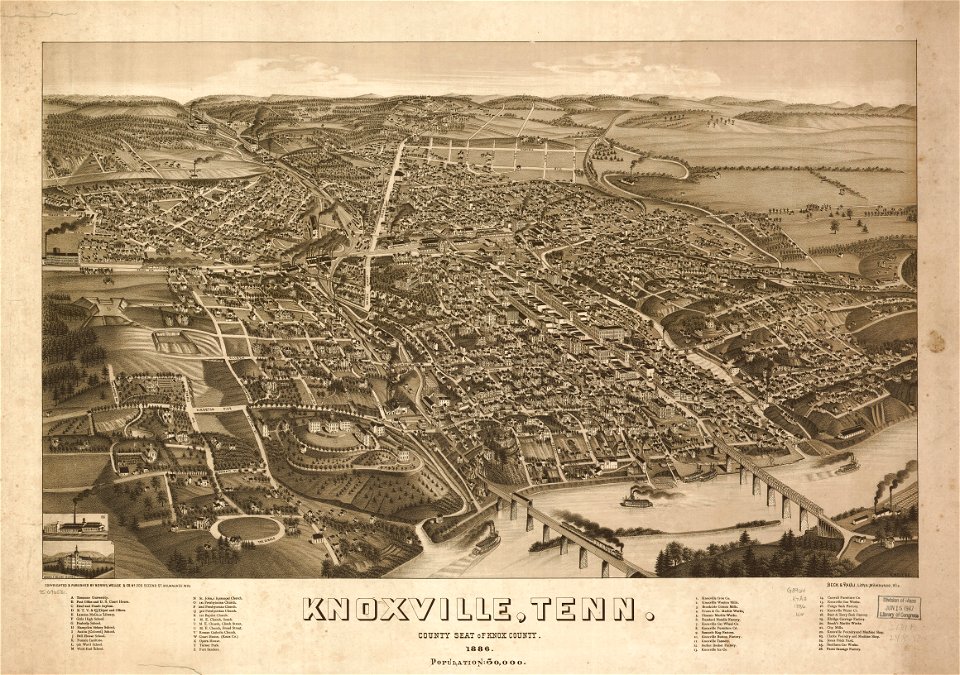
tennessee
1886
tennessee
1886
geographical illustrations by coronelli
old maps of the peloponnese
geographical illustrations by coronelli
old maps of the peloponnese
ships on maps
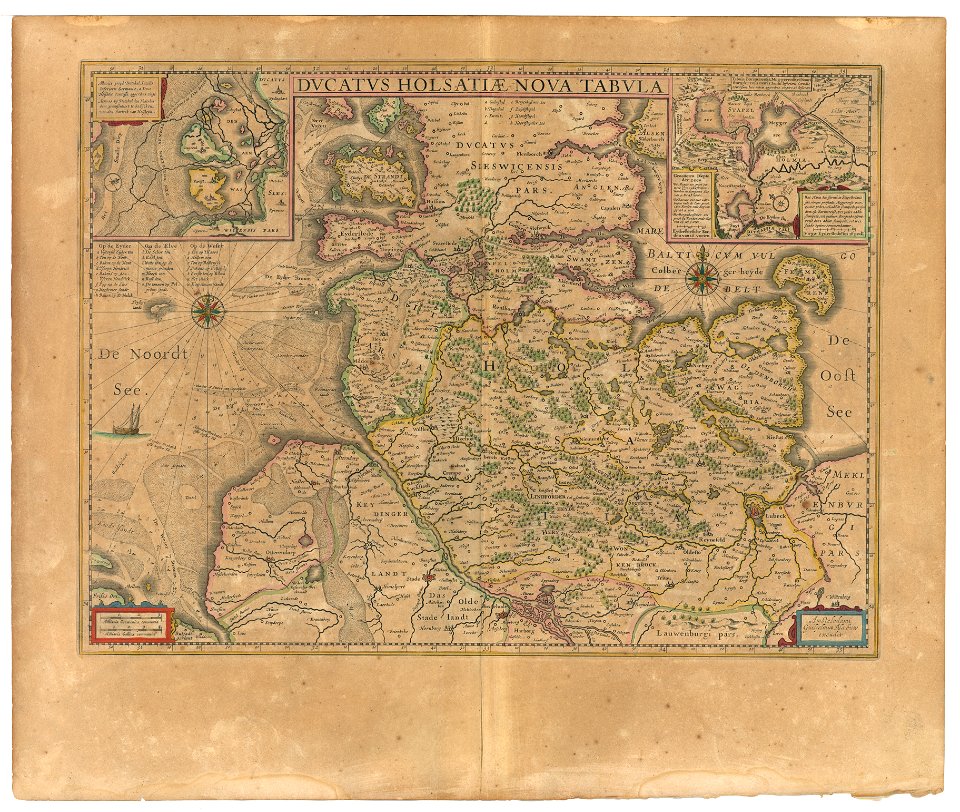
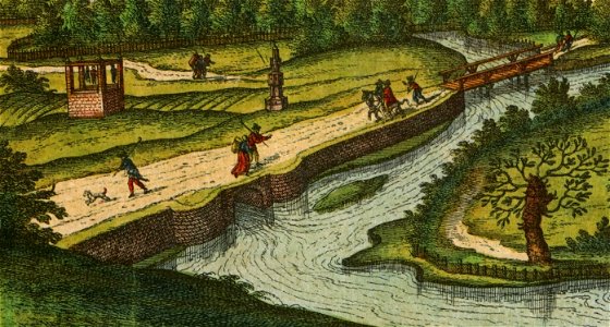
brunsbüttel
prints from marana espion turc at the peace palace library
maps of valenciennes
maps and topographical views by joris hoefnagel
historical images of brno
illustrations of cosmographia (münster)
old maps of asia
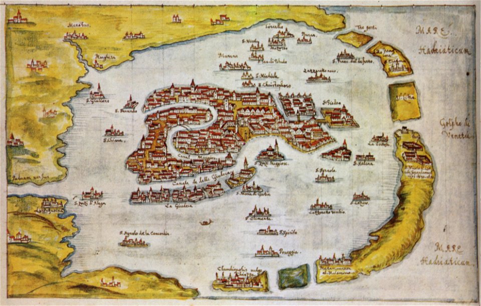
kurtze beschreibung von republick venedig
17th-century engravings of towns
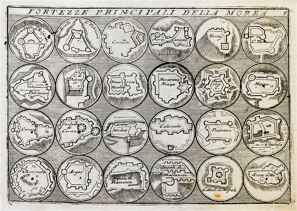
geographical illustrations by coronelli
old maps of the peloponnese
bibliothèque municipale de reims
rès. g 153
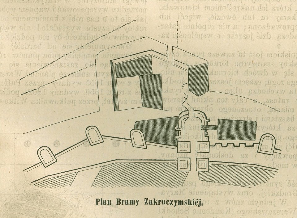
historical maps of warsaw
barbakan in warsaw
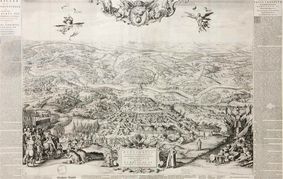
engravings of battles
willem blaeu
rhaetiae et valesiae
merian helvetiae
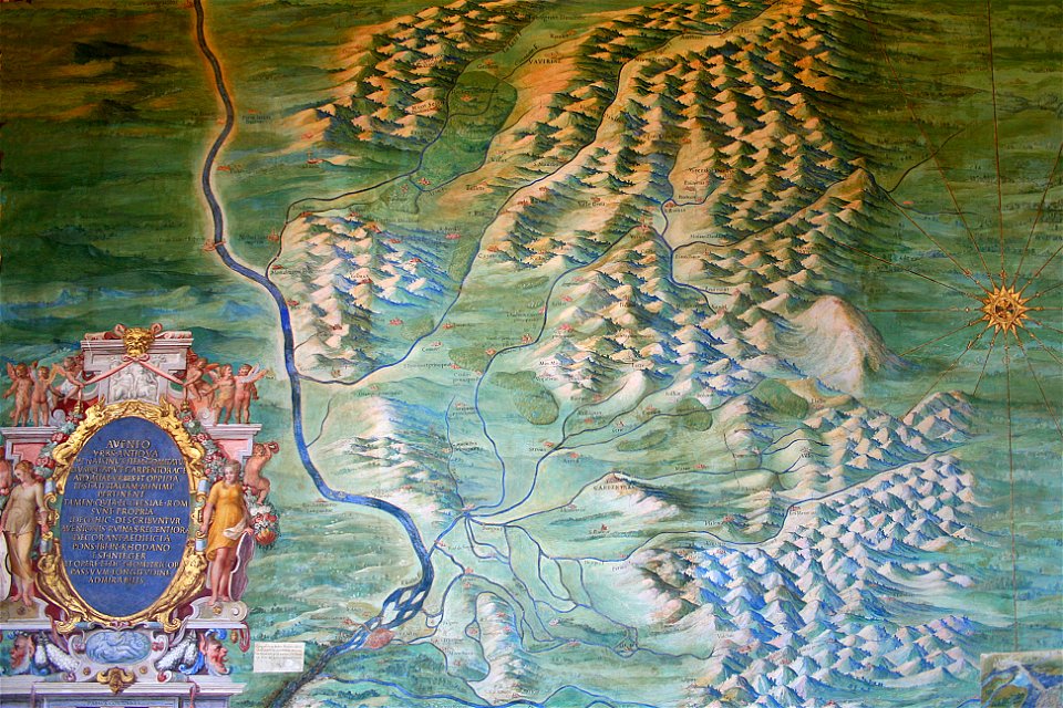
avenionensis ditio et venaisinus comitatus (galleria delle carte geografiche)
maps of comtat venaissin
engravings of topographia bohemiae moraviae et silesiae
history of kolín
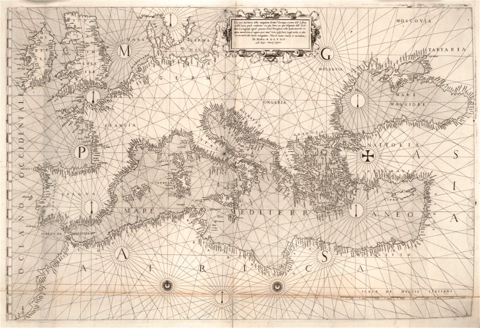
16th-century maps of the black sea
maps in the library of congress
16th-century maps of the black sea
maps in the library of congress
history of the french navy
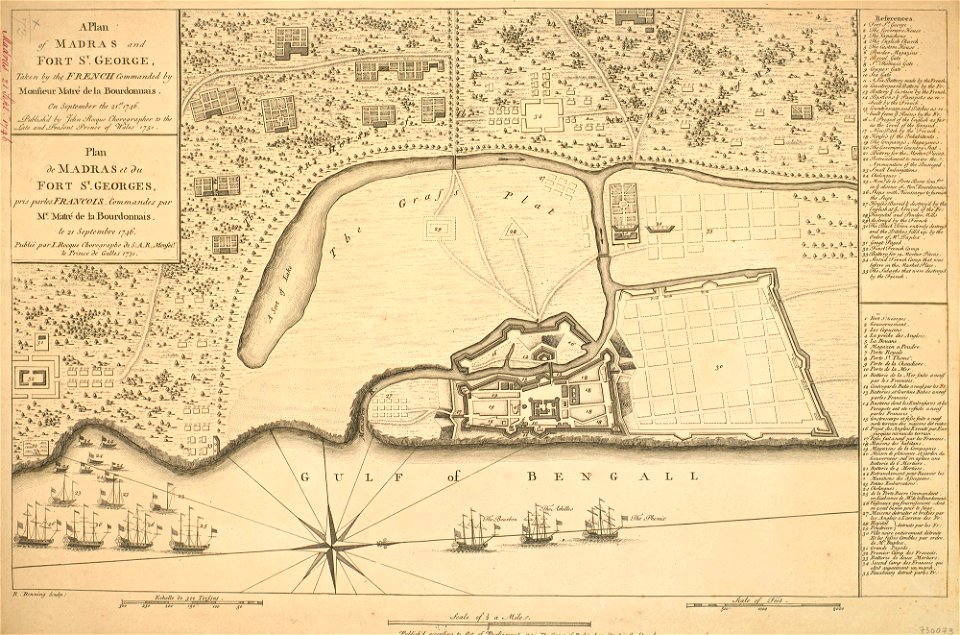
fort st. george
old maps of the democratic republic of the congo
lake tanganyika
coats of arms of switzerland
coats of arms of italy
paris in the 16th century
lithographs of paris
history of rail transport in switzerland
aussersihl
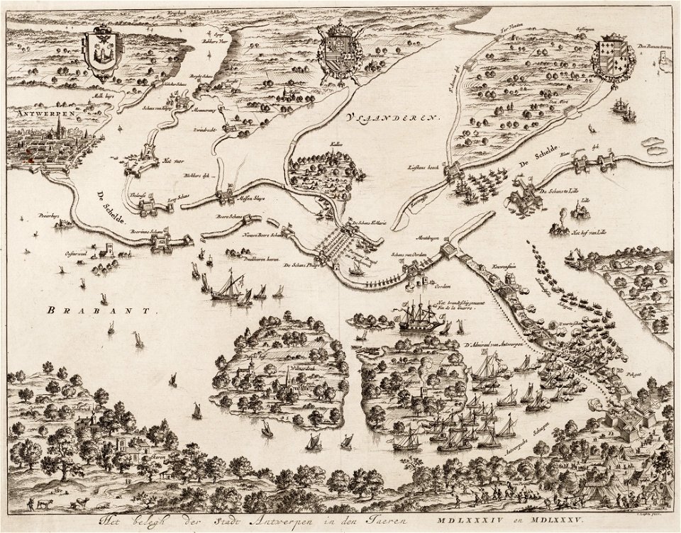
antwerp
hoboken
historical images of parvis notre-dame - place jean-paul ii
spire of notre-dame de paris
playbills
rococo
christian friedrich boetius
johann sebastian bach
ermine (clothing) in art
artist missing
cádiz in the 19th century
scanned spanish texts
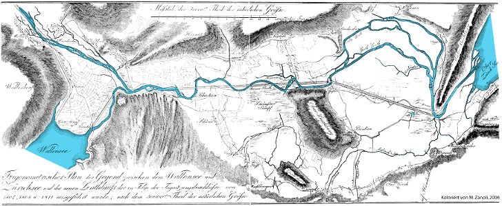
linthebene
linth
architectural prints by wenzel hollar
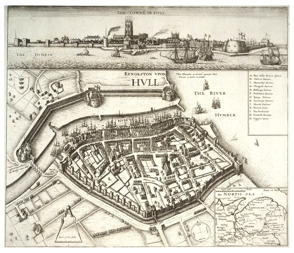
fortifications of kingston upon hull
genroku kuniezu
suo province
journal de relâches du croiseur ecole d'application l'iphigénie : campagne 1887-88
maps of dakar
drawings and watercolours of the royal museums greenwich
printing
files from the bodleian libraries
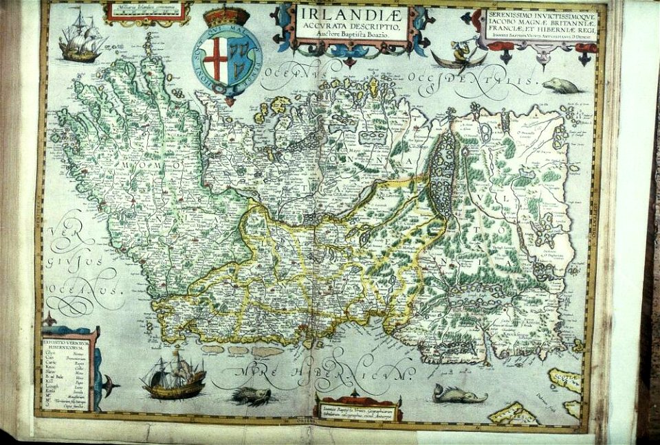
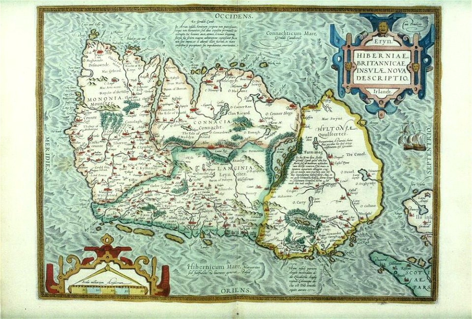
old maps of ireland
files from the bodleian libraries
old maps of ireland
theatrum orbis terrarum (london 1606)
files from the bodleian libraries
files from the bodleian libraries
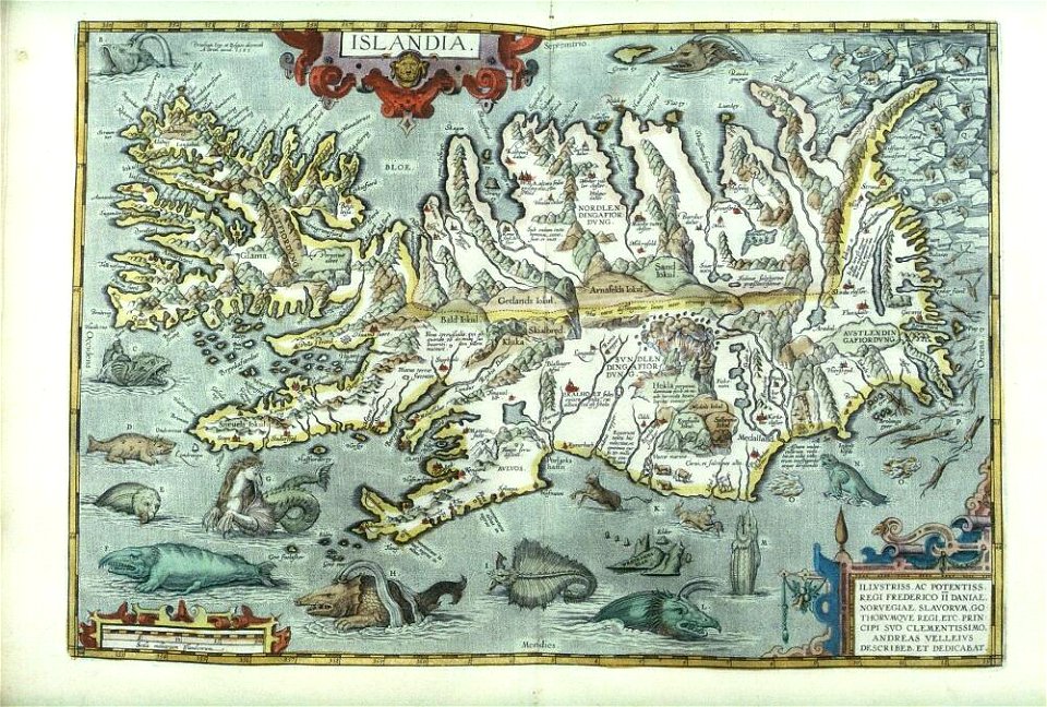
old maps of iceland
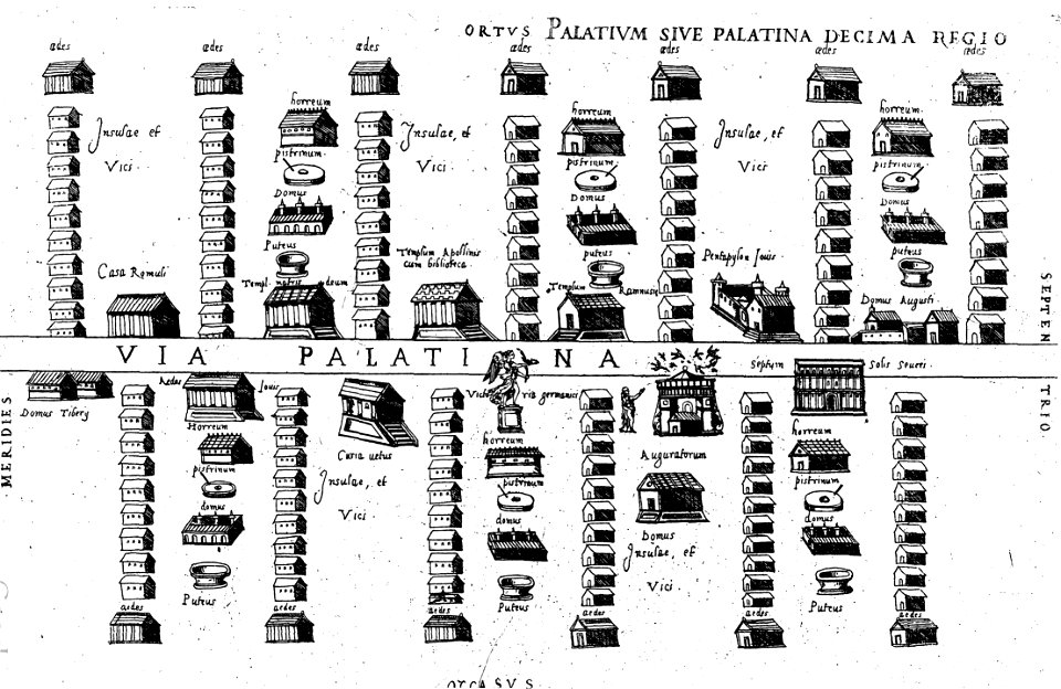
old maps of ancient rome (city)
16th-century engravings
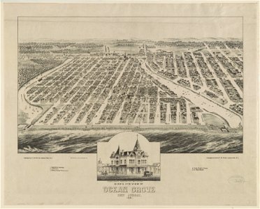
historical images of ocean grove
new jersey
historical images of ocean grove
new jersey
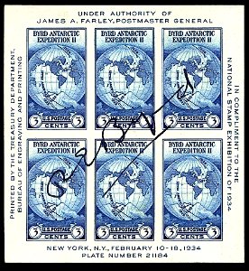
1934 stamps of the united states
blue stamps
impressive
printing
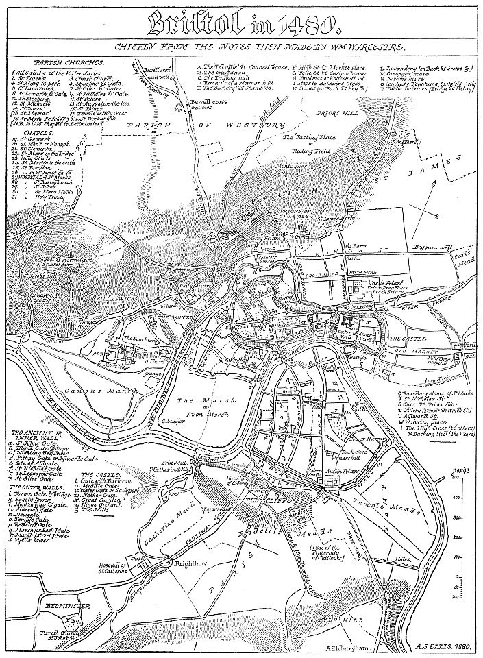
images from bristol past and present (1882)
old maps of bristol
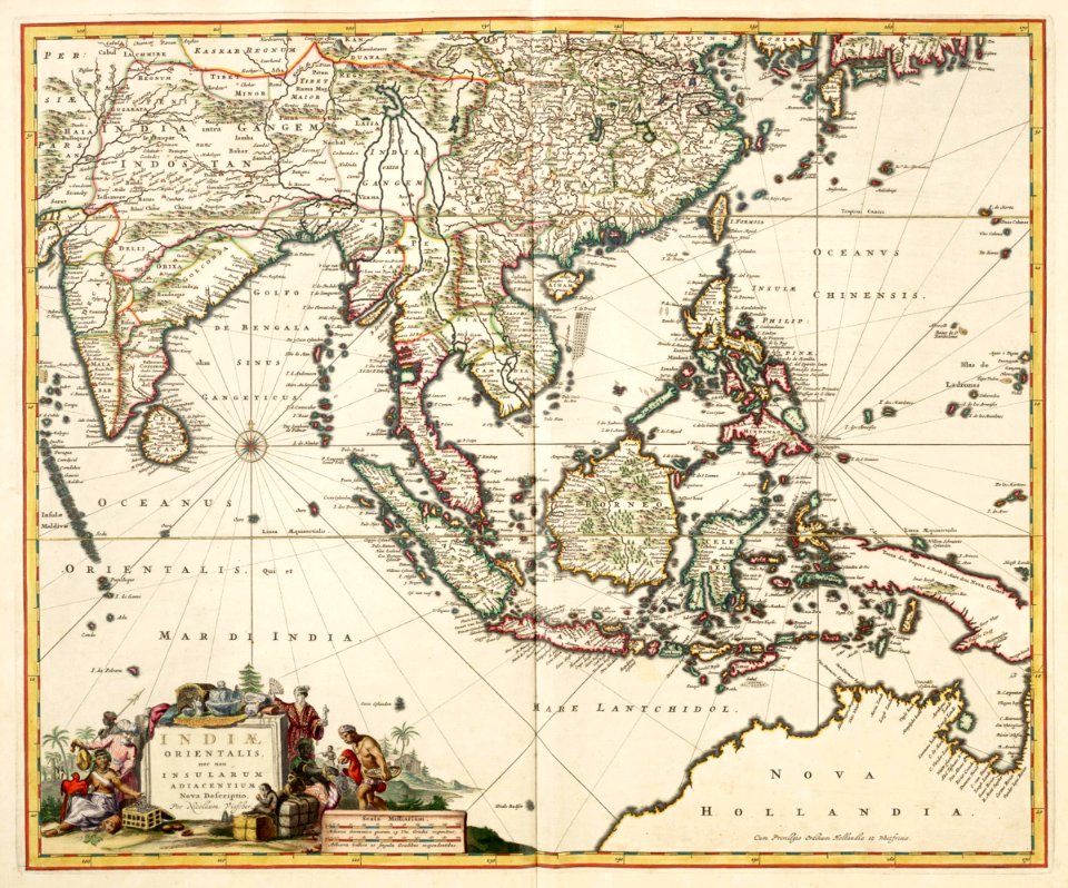
maps of the dutch east india company - india
1680s
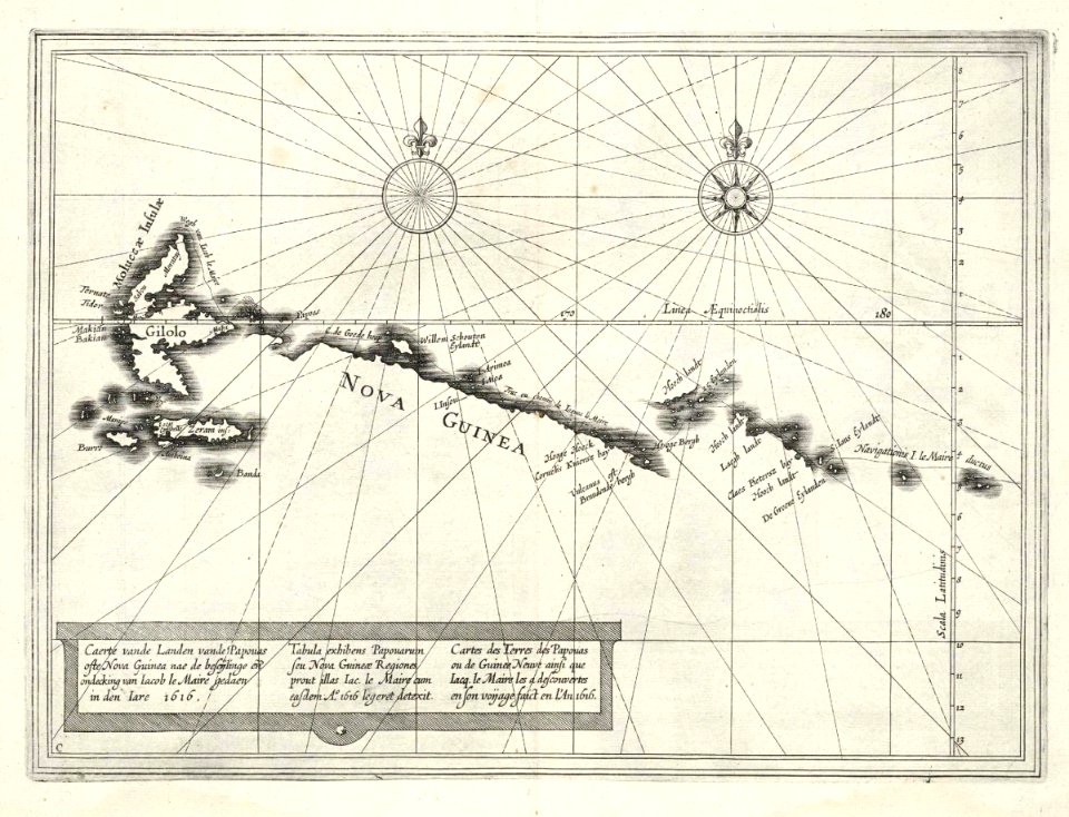
maps of the dutch east india company - indonesia
1616
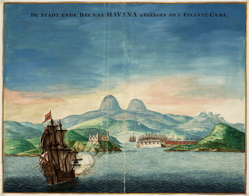
historical images of havana
1665
maps of the dutch east india company - india
1672
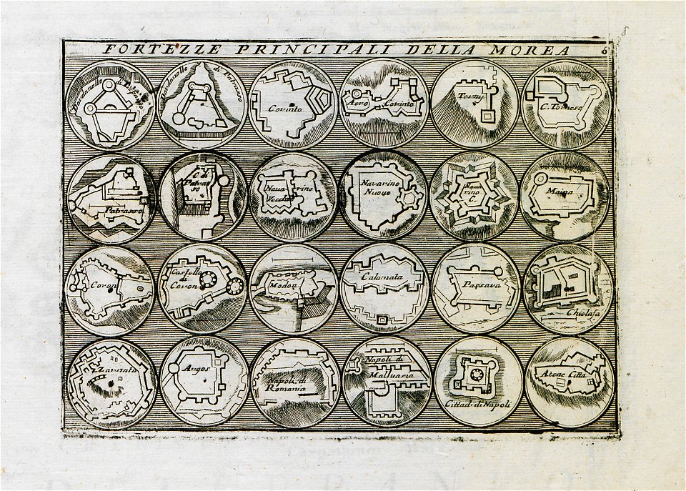
geographical illustrations by coronelli
old maps of the peloponnese
historical maps of mainz
braun & hogenberg
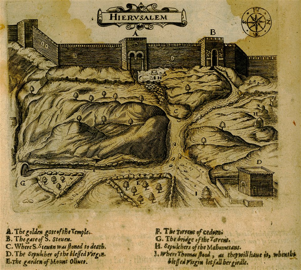
historical images of jerusalem
braun & hogenberg
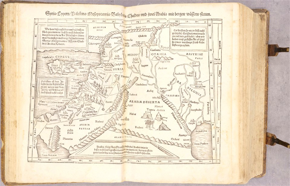
cosmographia - beschreibung aller lender durch sebastianum munsterum (1545)
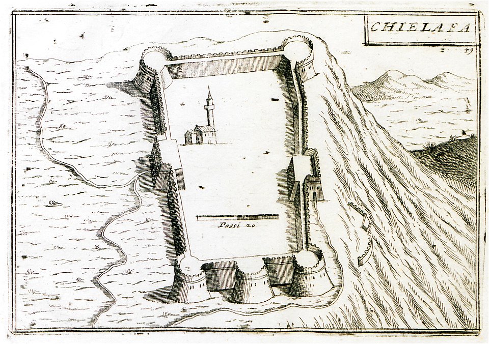
old maps of the middle east
19th-century maps of cuba
cuba in the 1840s
maps by jacques-nicolas bellin
forbidden city in art
miniature speed atlas (1627) pieter van den keere
maps of wales by john speed
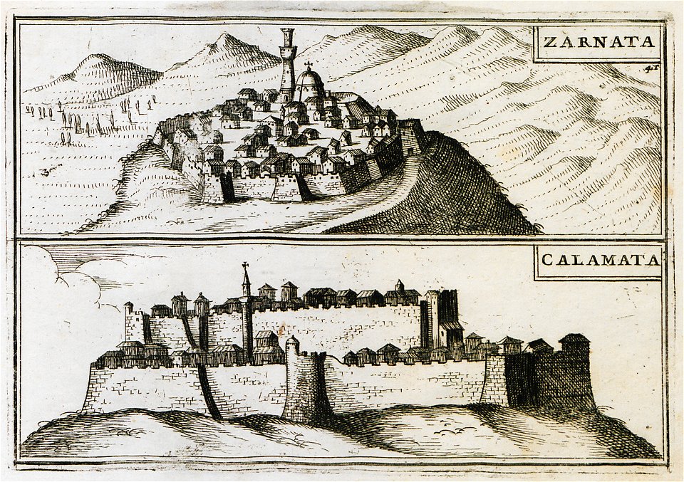
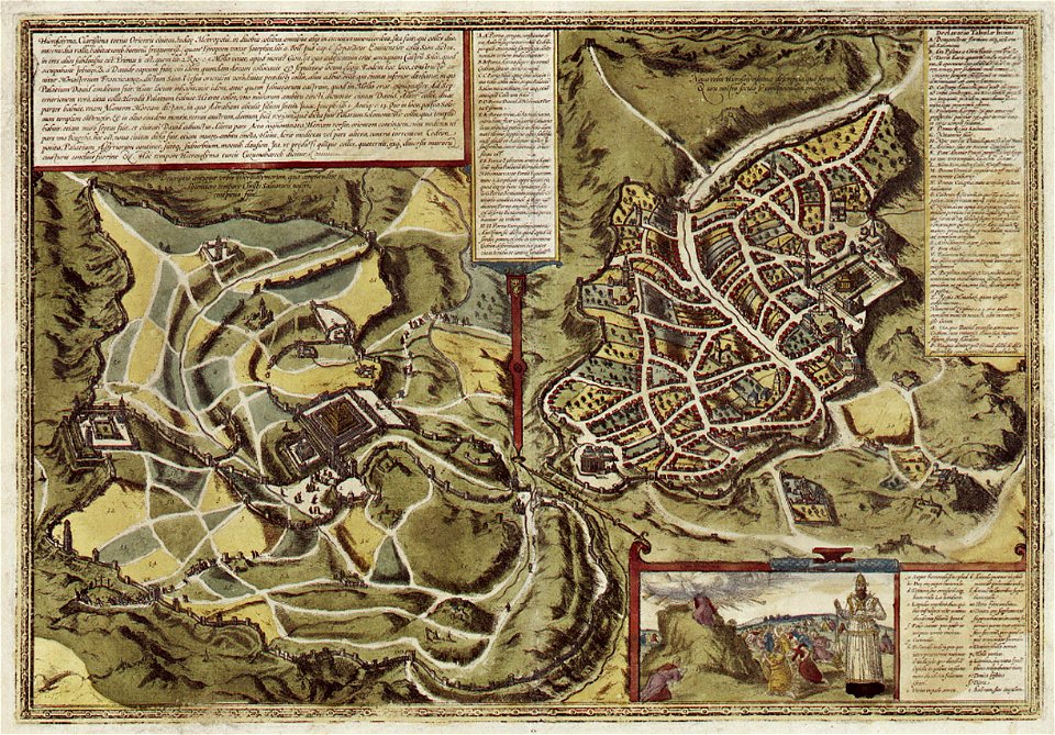
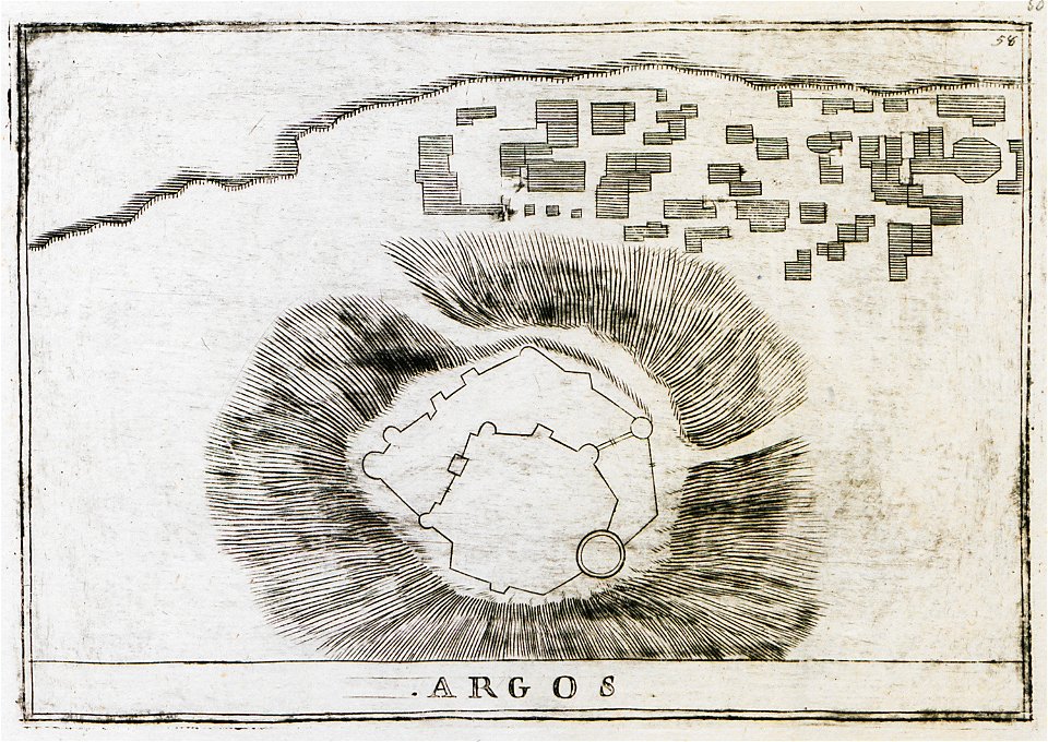
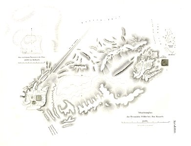
history of argos
argos castle
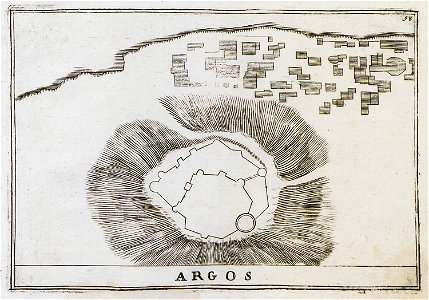
history of argos
argos castle
paintings of hunting
maps in art
maps made in the 17th century
history of wolin
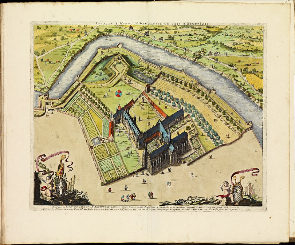
atlas van der hagen
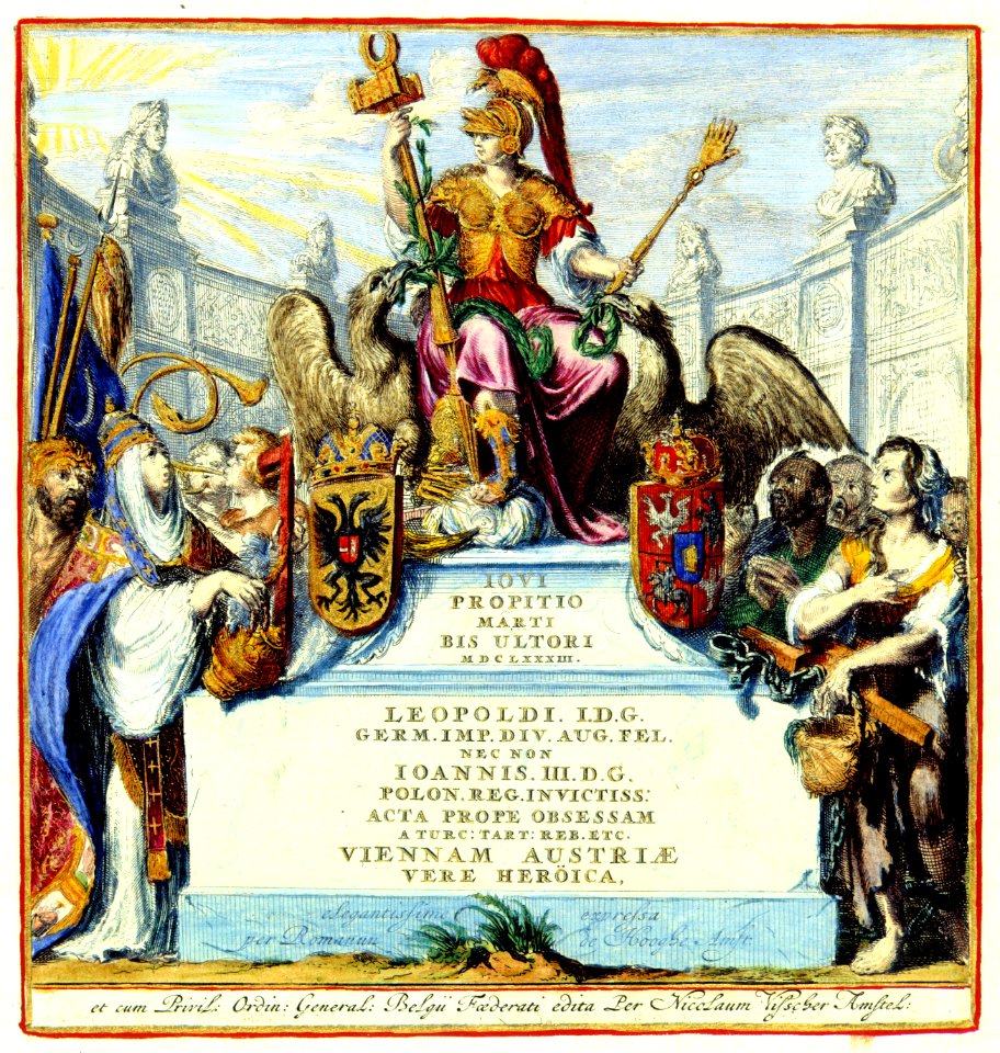
old maps of vienna
title pages of maps
atlas van der hagen
title pages of maps
atlas van der hagen
images with rulers to indicate scale
atlas de wit 1698
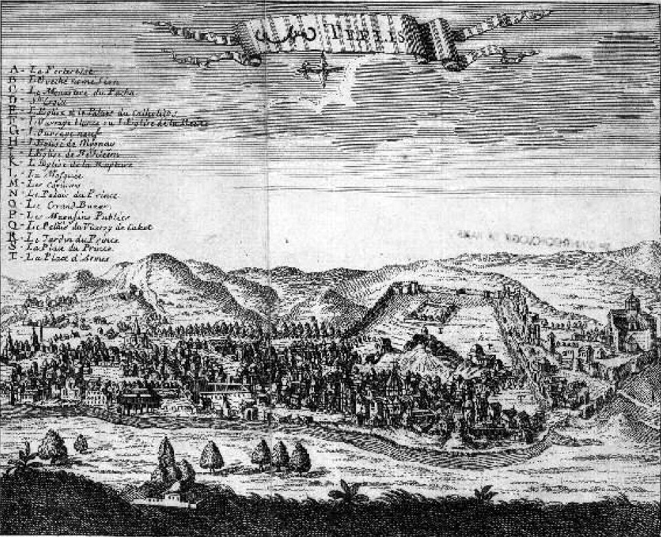
tbilisi in the 17th century
jean chardin
atlas de wit 1698
frederick de wit
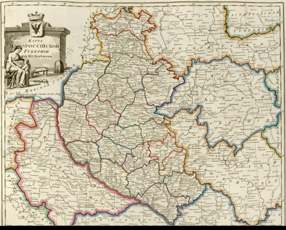
old maps of governorates of the russian empire
atlas of the russian empire (1800)
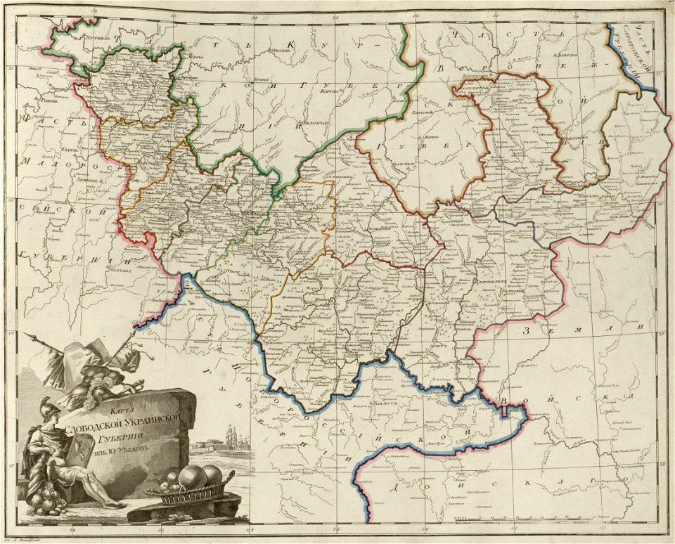
old maps of governorates of the russian empire
atlas of the russian empire (1800)
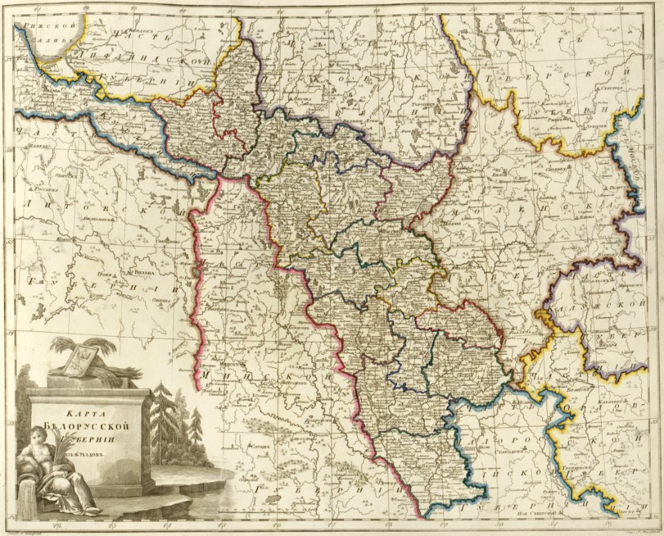
old maps of governorates of the russian empire
atlas of the russian empire (1800)
old maps of governorates of the russian empire
atlas of the russian empire (1800)
old maps of governorates of the russian empire
atlas of the russian empire (1800)
files from the bodleian libraries
old maps of africa
old maps of venice
gabriel bucelin
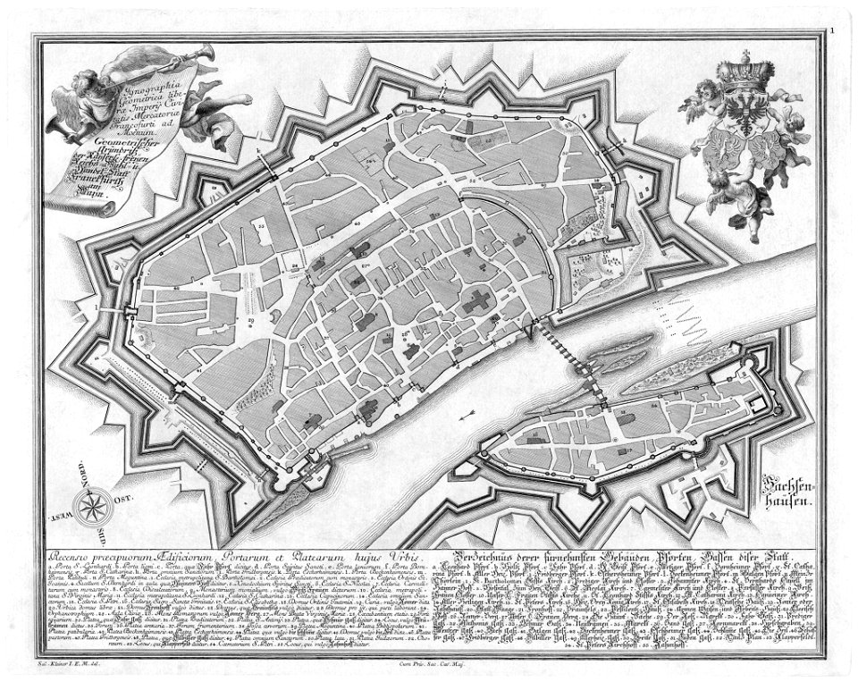
maps of frankfurt am main showing 18th-century history
das florirende franckfurth am mayn
old maps of zürich
zürich
historical images of jerusalem
relation of a journey (sandys)
maps by frederick de wit
copper engraving
kutepov's hunting - illustrations (volume 1)
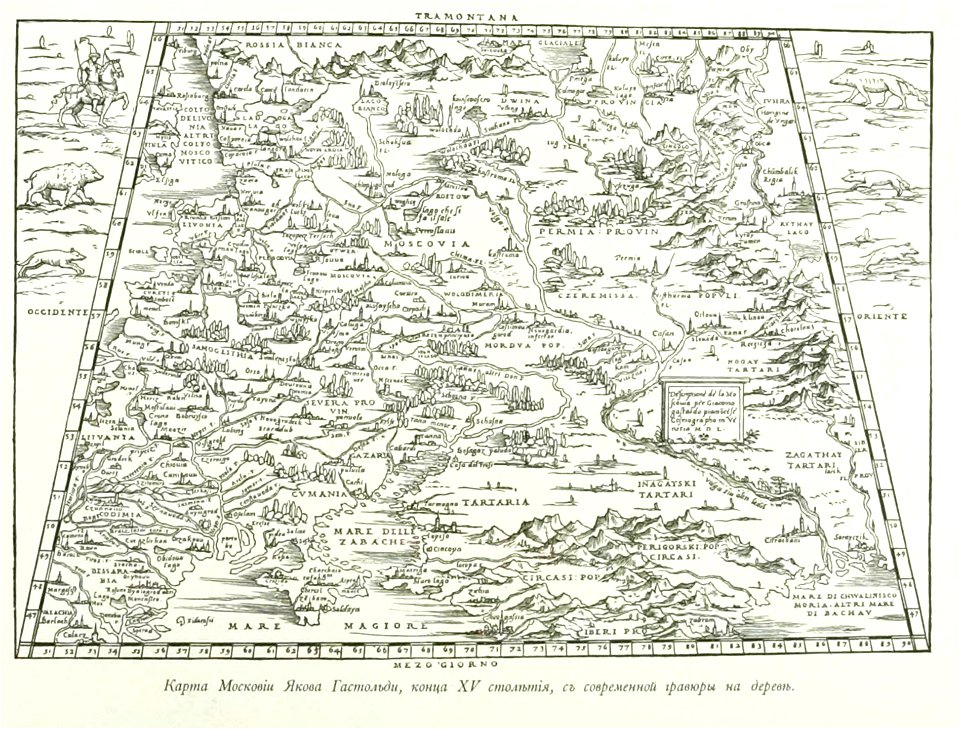
old maps of the tsardom of russia
small atlas of the russian empire (1796)
kharkov viceroyalty
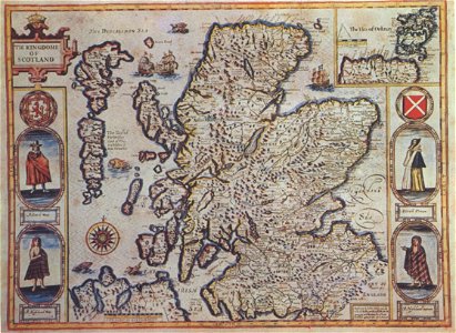
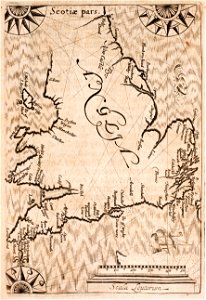
scotland in the 17th century
history of scotland
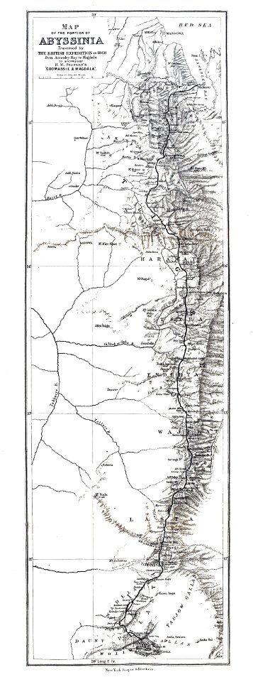
british expedition to abyssinia
henry morton stanley
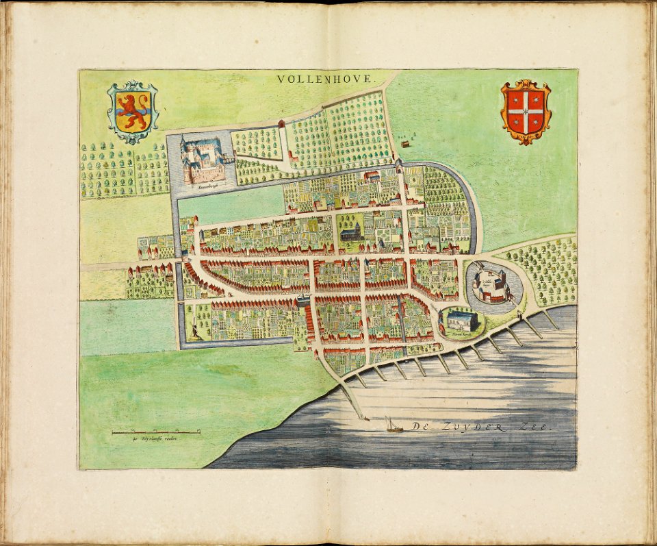
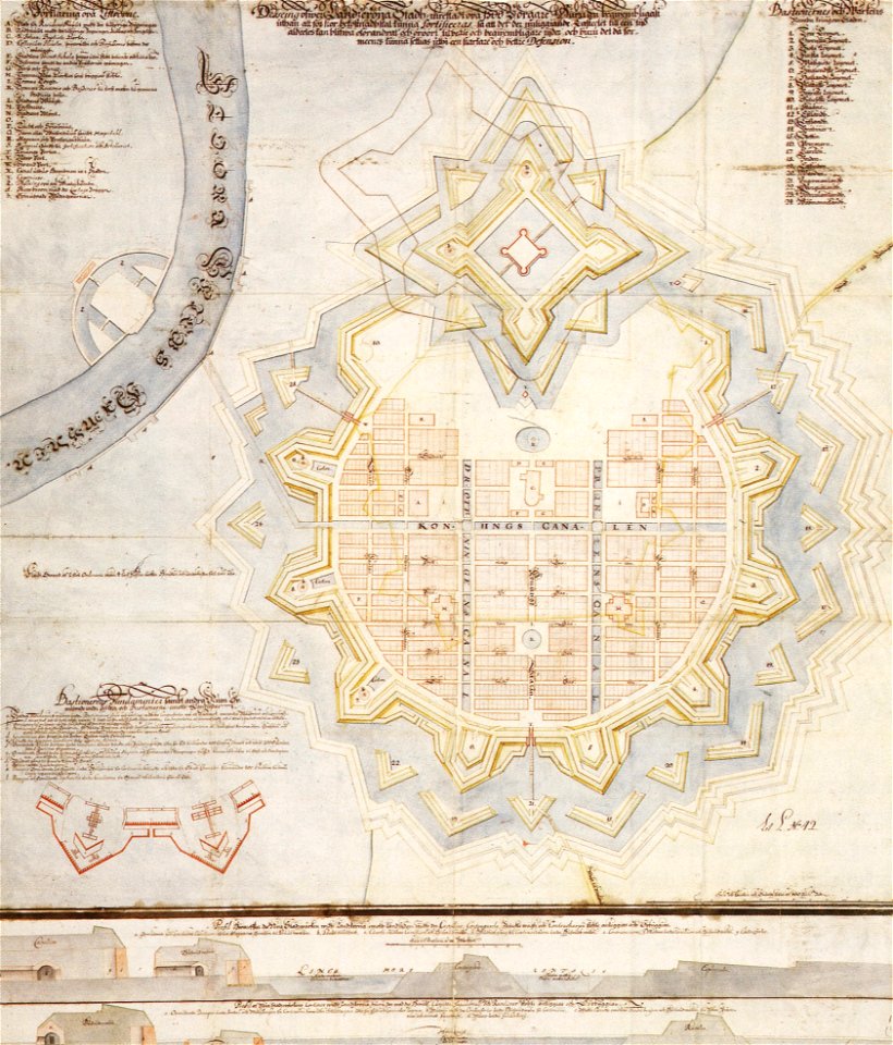
old maps of cities in sweden
landskrona
19th-century maps of the united states
volume 1 of le tour du monde
prints from the peace palace library
1652
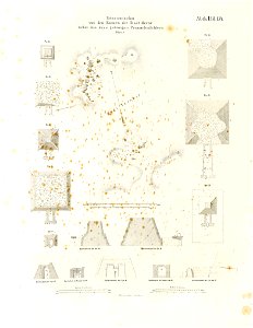
lepsius-projekt - maps
pyramid of djedefra
monument and memorial sections
lepsius-projekt - pyramids
volume 9 of le tour du monde
john hanning speke
prints from manesson travaux de mars at the peace palace library
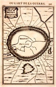
maps of bruges
a chaplain's experiences
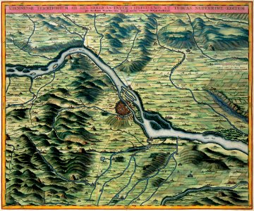
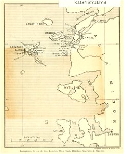
old maps of turkey
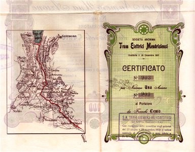
bonds and shares of edhac members
mendrisio electric tramway
tinco martinus lycklama à nijeholt (1837-1900)
unidentified maps
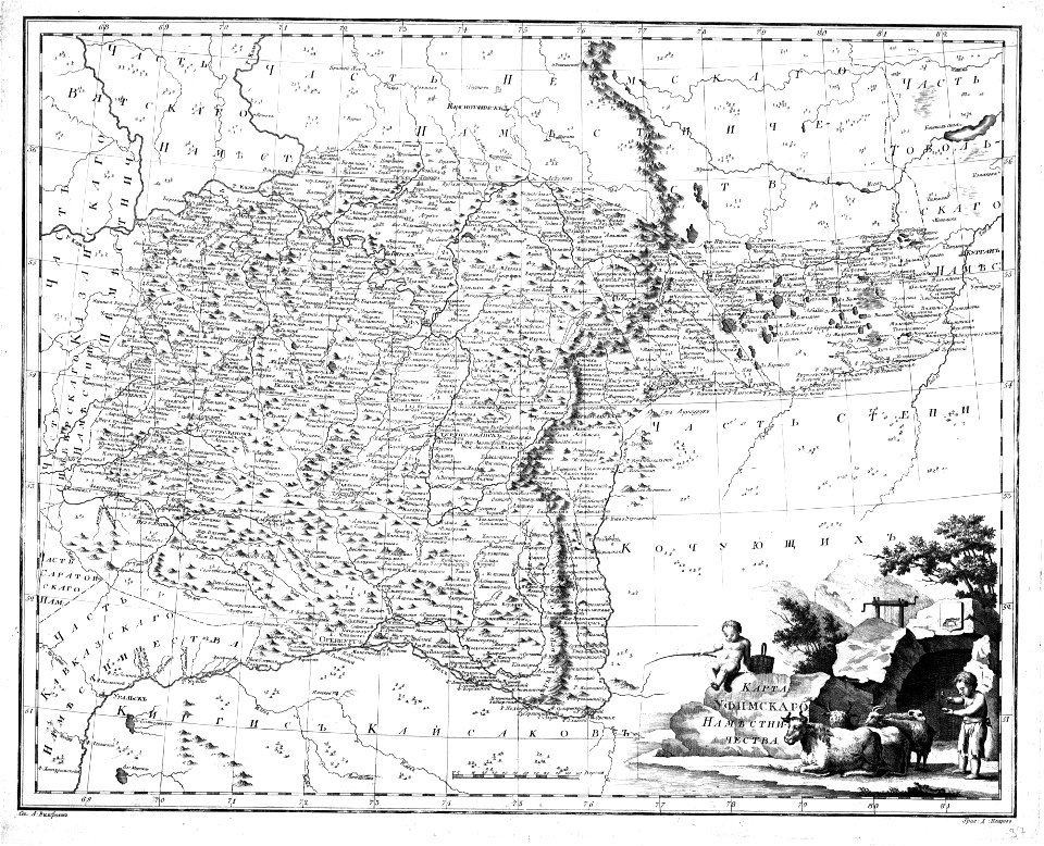
maps of the history of bashkortostan
atlas of the russian empire (1792)
1638 in switzerland
sihlkanal (zürich)
8601 - 8700 of 33,440
Next page
/ 335